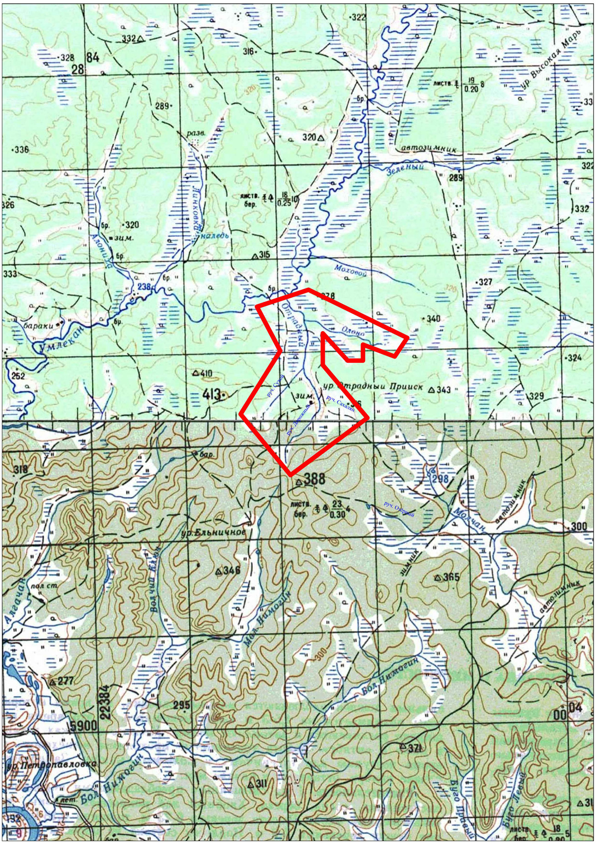
Otradnyy placer gold deposit is located in the Zeyskiy district of the Amur region. The property lines of the licensed area enclose the valley of the Otradnyy stream (the right tributary of the Umlekan River) with its right tributaries – Olono and Sakhalyan (Sakhalin) and the left tributaries – Dorozhnyy and Sukhoy streams. The area is a plateau plain dissected by a net of deep erosion valleys into flat and wide water-dividing spaces.
The Otradnyy stream continues down to 8,5 km. The valley is a flattened, very wide (up to 500 meters in the outflow), swamped bog. The tributaries continue down to 2-3,5 km; the width is 100-400 meters. Permafrost with small talik areas is common.
The licensed area is located within the boundaries of the Umlekan gold-bearing cluster of the Zeya-Selemdzhin gold-bearing region. Sedimentary rocks of the Depskiy downfold – tuffaceous sandstones, siltstones and of the Depskaya suite of the Upper-Jurassic age are developed in the area. They are topped off by the Taldan suite volcanites of the Lower-Cretaceous age. Greenstones of the Early Cretaceous Burindin complex are common for the underset current of the Otradnyy stream. Quartenary alluvial sediments enclosing placer gold deposits are developed in the valleys of the stream flows.
The north flank of the gold, silver and copper prospects is located in the water-dividing line of the Otradnyy and Elnichnyy streams.
Reserves of the placer gold deposit amount to approximately 1,3 tonnes.
Total area – 23,4 sq. km.