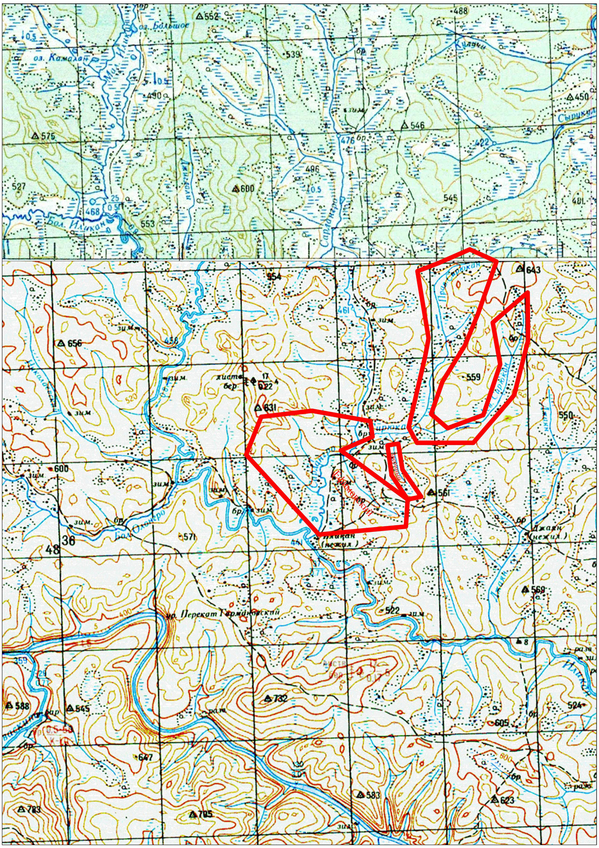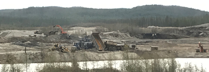
Sardangro placer gold deposit is located in the Zeyskiy district of the Amur region. The property lines of the licensed area enclose a part of the valley of the Sardangro River (the right tributary of the Ilikan River) in the underset current, together with the right tributaries – Accent and Accord streams, the left tributary – Yefimovskiy stream and the valleys of the Siruykan basin streams – Right Siryukan, Dorozhnyy (Left Siryukan), Zverinyy. The landscape of the area is poorly broken.
The Sardangro River continues down to 2,2 km within the boundaries of the licensed area. The valley is wide (400-800 m) with flat sides. The valleys of all the other stream flows have the same properties. The cross-sections of the valleys are patelliform and U-shaped, symmetrical. In the underset current of the Sardangro River one terrace above the flood-plain is recorded. A polygenetic terrace is well-developed – the surface is alluvial with permeative junctures with the banks and floodplain of the river.
The licensed area is located within the boundaries of the Ilikan-Unaha gold-bearing region.
In terms of the geologic setting, the area is formed by gneisses, crystalline schist interlayered with amphibolite, quartz rock and crystalline limestone of the Dzhigdalin suite of the Upper Archean age, broken by granites of the Early Proterosoic complex. In the splits areas of the north-west and north-east strike, the rocks are interstratified and silicified. Quarternary alluvial deposit of the valleys of the Sardangro River, Dorozhnyy and Yefimovskiy streams encloses placer gold deposits. Ore bodies of the placer deposits present areas of diaphthoresis, crumpling and foliation affected by hydrothermal alteration.
Total reserves of the placer gold deposits amount to approximately 3,2 tonnes.
Total area – 38,15 sq. km.